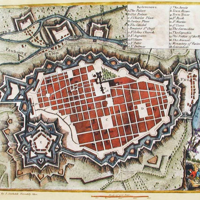
Team Turin has drawn inspiration from this dominant image of the city as a fortress guarding critical pathways by researching how the city’s transportation system, industry, monuments, and borders were all affected by its history and geography. The first deliverable from this research is an analog and digital mapping module that instructors can implement to help students become immersed in Turin as a historical and a living city.

Mark Olson, Edward Triplett
2020
Type: Lab
Turin is a northern Italian city with many claims on its identity. On one hand, it is the epicenter of the Italian automobile industry and the smart city movement, and on the other it is the home of the Shroud of Turin, star-shaped bastions and the capital of the Duchy of Savoy. As the largest city in the Piedmont, it has a long history of prominence at the crossroads between Italy, France and Switzerland. Turin is also a city that is perpetually drawn and photographed with the Alps rising behind it.